This time of year there is not too much to worry about when it comes to measuring the River Sid.
There is of course regular measuring and monitoring carried out along the Sid, by members of the SVBG’s team working with the Westcountry Rivers Trust and other partners.
This is all about the quality of the waters. But there is also measuring and monitoring done of the actual levels of the waters which run the course of the River Sid – and which is not only usually low in the summer months but is particularly low at the moment due to the unusually low levels of rainfall.
There are the two official websites at gov.uk – the River Sid level at Sidmouth [currently at 0.05m] and the River Sid level at Sidbury [at 0.3m] – the readings for both measuring below what they would normally be this time of year.
The floodmapper website gives the River Sid level at the Sidbury station in Sidbury – as well as useful information such as what’s happening at nearby Combined Sewer Overflow [CSO] or Discharge Stations.
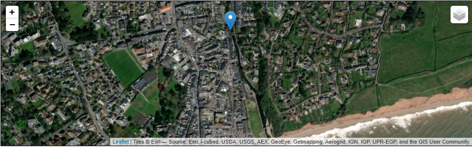
But perhaps the most informative place to go is the UK River Levels website and the page on the River Sid at Sidmouth – which also shows a map of where the measurement is taken, and that is at the ford on Mill Street, which accounts for the very low score of 0.05m.
.
With thanks to River Sid at Sidmouth :: the UK River Levels Website
…